
Fixing the Network by Fixing the Route
- Srihari Maddula
- Jan 7
- 4 min read

Why Geo-Aware Maintenance Routing Is the Quietest, Most Profitable Upgrade Utilities Can Make
Utility failures rarely happen because equipment is invisible.
They happen because response is late, misdirected, or inefficiently sequenced.
Across electric, water, gas, and municipal services, utilities invest heavily in sensing. Outages are detected. Alarms are raised. Dashboards light up. Yet customers still experience long downtimes, crews travel inefficiently, and small faults escalate into larger incidents.

When post-incident reviews are conducted, the story is familiar. The issue was known early. The response was fragmented. Crews were dispatched sequentially rather than strategically. Geography was treated as a map, not as an operational constraint.
What is changing now is not sensing capability, but how utilities reason spatially about response.
Geo-aware maintenance routing—when designed correctly—turns detection into resolution far more efficiently than adding more sensors ever could.
The Misplaced Faith in Detection Alone
Over the past decade, utilities have made impressive strides in fault detection.
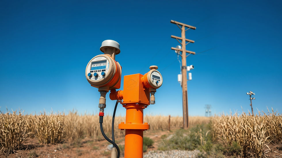
Smart meters report outages automatically. Line sensors flag anomalies. Pressure and flow sensors identify leaks. SCADA systems provide real-time telemetry.
Detection is no longer the bottleneck.
The bottleneck is what happens after detection, when information must be converted into action across a geographically distributed workforce operating under time pressure.
In many utilities, this translation still relies on manual dispatch, static priority rules, and operator experience. Crews are sent one ticket at a time, even when multiple issues are spatially related. Vehicles crisscross service areas inefficiently. High-priority faults are addressed, but the system misses opportunities to resolve adjacent issues at marginal additional cost.
From a business perspective, this results in higher downtime, higher fuel and labour costs, and frustrated customers—despite having “good data”.
Why Geography Is the Real Constraint
Utility networks are physical systems.
Pipes run underground. Lines span terrain. Assets cluster in predictable patterns shaped by urban growth, terrain, and historical planning.
Failures, therefore, are rarely isolated. A transformer fault stresses neighboring equipment. A water main leak alters pressure across a zone. A gas anomaly often correlates with nearby excavation or load changes.
Treating each service ticket independently ignores this spatial reality.
Geo-aware routing acknowledges that where faults occur matters as much as what faults occur.
From Dispatch to Orchestration
Traditional dispatch answers a simple question: which crew should respond to this ticket?
Geo-aware orchestration asks a more powerful one: what is the optimal sequence of actions across space and time to stabilise the network fastest?
This shift changes the nature of response.
Instead of sending crews reactively, the system clusters faults spatially and temporally. It considers travel time, crew capability, asset criticality, and downstream risk. It prioritizes routes, not tickets.
This does not require exotic AI. It requires disciplined geospatial reasoning applied consistently.
Where Edge Intelligence Fits In
Geo-aware routing becomes far more effective when combined with local, edge-level signals rather than relying solely on central alarms.
Edge sensing—sometimes including simple vision cues at substations, pumping stations, or roadside assets—adds context that central systems often miss. Visual confirmation of flooding, obstruction, physical damage, or unsafe access conditions informs routing decisions in real time.
This matters operationally.

A crew dispatched without awareness of on-site conditions may arrive unprepared, waste time, or need to return later with different equipment. Edge-derived context reduces these inefficiencies by aligning response with reality.
The goal is not detailed visual inspection, but early situational clarity.
Vision as Context, Not Surveillance
In utility environments, vision is often viewed with suspicion due to privacy, cost, and maintenance concerns.
Edge vision systems succeed here precisely because they are narrowly scoped.
They do not stream video continuously. They confirm conditions when triggered by events—water pooling where it shouldn’t, physical obstruction near assets, visible damage after storms.
Processing happens locally. Only structured observations are transmitted.
This keeps data volumes low, reduces privacy exposure, and makes deployment politically and operationally feasible.
Turning Maps Into Operational Intelligence
Most utilities already use GIS systems. Assets are mapped. Service areas are defined. Boundaries exist.
What is often missing is dynamic reasoning over those maps.
Geo-aware routing systems treat GIS not as a static reference, but as a live constraint engine. They reason about adjacency, accessibility, load propagation, and crew reachability continuously.
For example, when a fault occurs, the system can identify nearby assets at risk, other open tickets within a defined radius, and crews whose current routes could be adjusted with minimal cost.
This turns maps into decision tools rather than documentation artefacts.
Why Routing Efficiency Beats Headcount Expansion
Utilities under pressure often respond by hiring more crews or outsourcing work.
This approach is expensive and slow to yield returns.
Geo-aware routing often delivers comparable or better improvements by reducing wasted motion, not increasing manpower.

When crews resolve multiple spatially related issues in a single route, travel time drops. When priority is assigned with network-level awareness, cascading failures are prevented. When response is faster, customer impact decreases.
From a financial standpoint, these gains compound over time.
Predictability Is the Real KPI
Utilities frequently measure performance in terms of mean time to repair or number of tickets closed.
These metrics matter, but they hide an important dimension: predictability.
Customers tolerate outages better when restoration estimates are accurate. Regulators respond more favourably when incident narratives are coherent. Internal teams operate more calmly when response plans are clear.
Geo-aware routing improves predictability by aligning plans with geography, not just urgency.
LLMs Support Explanation, Not Control
Large language models are increasingly used in utility operations to summaries incidents, generate reports, and assist planning.
Their effectiveness depends on structured inputs.
Geo-aware systems provide exactly that: spatial clusters of faults, route decisions, and time-based progression. LLMs can then explain why certain routes were chosen, what risks were mitigated, and how response evolved.
This keeps accountability with operators while reducing administrative overhead.
Risk Reduction Through Fewer Surprises
One of the most underestimated benefits of geo-aware routing is risk containment.
When response is spatially optimised, fewer assets remain in stressed states longer than necessary. Secondary failures are reduced. Emergency escalation becomes rarer.
From a system-level perspective, this increases resilience without adding complexity.
The Strategic Question Utility Leaders Should Ask
Before investing in more sensors, more dashboards, or more crews, utility leaders should ask a different question:
Are we optimizing detection, or are we optimizing resolution?
Detection without orchestration produces awareness. Orchestration produces stability.
At EurthTech, this distinction shapes how we approach utility systems. We focus on turning spatial reality into operational advantage—quietly, predictably, and at scale.
In networks defined by geography, the fastest fix is often the smartest route, not the strongest signal.


Comments